Tag Archives: hike

Vietnam, Sapa – Hiking and Rice and Everything Nice [Part III]

27 Oct

Our final day in Sapa was G’s favorite…

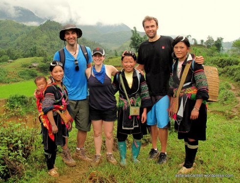
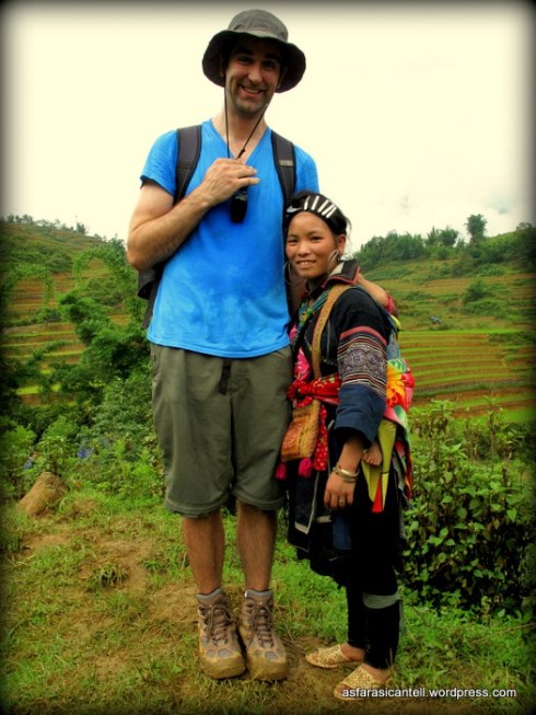
Mostly because he had finally met his match – the sweetest and feistiest H’mong girl who helped her mom lead us through the rice paddies fearlessly.

Our final day in Sapa was my least favorite…

Mostly because I had to hold-on for dear-life as we slipped and slide-d our way down the mountain.

(Frustration.)

Yes, indeed, to get down the muddy slopes of Sapa, I had to be fully supported (body, mind and soul) by a sweet old H’mong lady who was about 1/2 my size and had approximately 100 times my strength.

Don’t judge!

Each of us foreigners was equipped with a pint-sized support system…

This coupling happened to be my favorite:

Anyway, once we got the hang of mud-skiing, we were able to relax, look up, and start noticing the magical views around us.

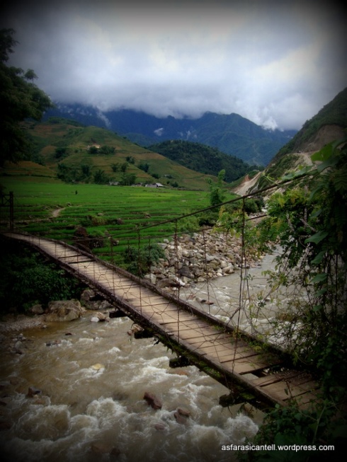
We crossed over bridges…

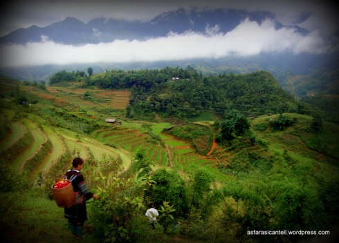
Hiked through hidden valleys…

Learned how to die clothes using indigo leaves (thanks to Cou, our FANTASTIC tour guide for the day)…

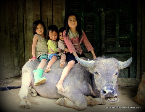
Met some new friends…

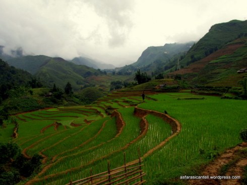
Saw some more perfectly sculpted rice fields…

And finished it all off with some pho…

(and a smile)

Guess it wasn’t such a bad ending to our trip after all.

Vietnam, N & P – we love you! Thanks for a perfect vacation.

***

For more information about Sapa, including details about transportation, tour guide and accommodation, see earlier posts about our trip here: PART I and PART II

Hong Kong Colada – A Tropical GetAWAY from the City

6 Dec

Celebration!

My broken camera (actually, G’s camera that I broke…lovingly) has magically fixed itself & now I can finally share some pictures from Hong Kong.

I have so much to tell you about our trip, mostly re: food, food and food (as usual), but I’ll start off with our most impressive and awesome Hong Kong activity- hiking the Dragon’s Back trail.

**Directions at the bottom of le post**

After two days of stomping around the high-rising city, waiting in lines (for eats, not museums…sorry dad) and pushing our way through markets, G and I decided it was high-time to nature-up & do a short hike called, Dragon’s Back trail.

The hike was nothing short of perfection- like a direct IV of gorgeous, straight to the system.

The trail was clearly marked and rather easy (an unexpected delight, after some of my more complicated Korean hiking experiences), so the 2 hours of walking were spent completely devoted to devouring the dramatic views of the South China Sea.

And the cherry on top? We had little hiking cheerleaders, who held signs of encouragement before the steep inclines.

I need to hire these ladies to cheer for me at the gym…

Anyway, the hike was over way too quickly (2.5 hours if you take your time and snap A LOT of photos), and G & I were not near ready to return to the hullabaloo of the city… so we opted to follow the trail to Shek O, a small beach-side village nearby.

I’m not sure what I expected (Maybe an extension of the city’s bustling downtown with a small beach attached?), but when we reached Shek O, I couldn’t believe my eyes- we stumbled upon a lazy, tropical, beach town in Hong Kong!

I had no idea this type of paradise exists only a few metro stops away from the city.

We sat on the beach for hours, reveling in our fantastic elastic (minute 1:25, if you watch the video) beachy discovery,  saddened only by the fact that we didn’t bring our bathing suits…

But the mocktails made up for it.

And thus ends my prescription for the antidote to city-life.  (If you ever need it.)

***

Directions:

To reach the trail-head, take the MTR to Shau Kei Wan Station, exit #A3.  From there, walk toward the Shau Kei Wan bus terminal and hop on Bus 9 (headed to Shek O).  Get off at Cape Collinson Road.  The bus should take about 15-20 minutes total.

The hike is approximately 4.5 kilometers long.

At the end of the trail, you can either take a taxi to Shek O, or head back to the bus terminal on Bus 9.

Easy as pie!


Mt. Yongmasan – Where a Hike Is So Much More Than Just Walking

22 Nov

A few weekends ago, when the weather was still warm enough for T-shirts and spur-of-the-moment hikes, G & I made our way to Mt. Yongmasan (용마산).

**Directions and details at bottom of post**

The Yongmasan trail was supposed to be a straightforward 2 hours of mindless hiking fun, but it actually turned out to be so much more…

So what exactly did this hike entail?

1.  Cardiac Arrest

At the beginning of the trail, I made the mistake of declaring to G that I wanted a LAZY hike.  None of that sprinting up the mountain- like we usually do. So, in order to set a slow and steady pace for ourselves, I told G that we should follow behind the 70 year old ajusshi (elderly man), who was also standing at the trail-head.  He would surly be a slow walker, right? WRONG!

Next thing I know, I’m freaking running to keep up with this old man!  (Meanwhile G is having the laugh of his life.)  After about 15 minutes of  following the pace of Mr. Speedy Gonzales Kim himself, I nearly fainted.  Some visual evidence:

I know what you are thinking, “She is totally posing for this photo.” INCORRECT!  I was seriously on the verge of passing out.   You can tell because in the second picture taken, I am still too embarrassed to show my face, but you will notice my stomach sweat… which is clearly a sign of distress.

2. Alcoholic Picnic

If you are like me, you believe that the key to a successful hike is: (a) Nice Views (b) Good/Challenging Trail (c) A High Caliber Picnic (and not necessarily in that order).  Koreans seem to agree, as they take their hikes and their mid-hike picnics very seriously…

But lucky for me (and you), they take their drinking even more seriously.  That’s why, on the peaks of most mountain trails, you can find a makeshift outdoor bar, selling Makgeolli, the delicious Korean rice wine.

And for those hikers who nearly lost their lives in “an uphill battle” following the pace of an elderly man – a few cups of rice wine can really rejuvenate the spirits.

3. Ice Cream Party

We walked, we talked,

we saw some views…

But nothing was as exciting as spotting the ice cream man (seriously) at the vista point at the top of the mountain.

4.  The New Workout Plan

Actually, wait, I should take back that last statement – nothing was as exciting as eating our ice cream while watching other people work-out at the exercise park, which magically appeared along the trail.

5.  New Friendships

I guess that watching other people exercise must have been really exhausting because next thing we knew, G & I had stopped paying attention to the trail signs and got totally lost.  Luckily, the mountain was filled with hikers and we stopped a few strangers to ask for directions.

One particularly nice Korean man took pity on us (foolish white-folk) and decided to lead us all the way down the mountain.

And as we walked, a small love developed between the man with the yellow hat shirt & G.

G shared stories about his life in broken Korean, while the man with the yellow shirt shared his food.

You can bet that I was pretty happy with this arrangement.  Rice cakes, sweet potatoes and corn?  I’ll take it!

6.  Shoe Shine

It’s like the hike that keeps on giving, right?!  Well, get this, at the bottom of the mountain, the man with the yellow shirt instructed us to stand in line to clean our shoes…

Does hiking get better than this?

Oh yes, just wait.

7.  Children’s Grand Park

When we had finally reached the end of the trail, G & the man with the yellow shirt had a harder-than-expected time bidding adieu to one another.  (Cue Juliet, “Parting is such sweet sorrow…” No joke.) So, instead of hopping on the metro back home, like we had planned, the man with the yellow shirt insisted on taking us to one last adventure – a walk through the neighboring, Children’s Grand Park.

You just can’t make these things up.

We went to the botanical gardens & the zoo…

and now you understand what I mean when I said- it was so much more than a hike.

***

DIRECTIONS:

The best photo by photo directions can be found HERE.

Also, here are the directions per the Visit Korea site: Take Subway Line 7 to Yongmasan Station (Exit 2) → Walk into the entrance of Hanshin Apartments, and walk ahead → Go up the stairs next to the pavilion and take a right past the playground to an exercise facility → Next to the facility, go up the stairs behind the wired fence.

We followed the Visit Korea directions and got lost before reaching the actual hike.  I know, it’s a gift.  In case you find yourself in the same situation (walking aimlessly out of  Exit 2 of Yongmasan Station), make sure to be on the lookout for a sign like this:

Then just go up the stairs,

You’ll see an I Park Building in front of you, and just keep on walking along the trail until you reach a number of steep steps – which will lead you directly to the trail-head.

ENJOY!

Hiking Dobongsan in Bukhansan National Park

6 Sep

“Insanity Workout” has taken on a whole new meaning…

Say hello to Dobongsan (Mt. Dobong)!

The hike up Mt. Dobong in Bukhansan National Park is not for the faint of heart nor for the weak of thighs – this trail is TOUGH!

Okay, so maybe my friends and I accidentally took the dangerous route across the mountain ridge because we were too lazy to Google-Translate the warning sign, which probably read: “WALK THIS WAY ONLY IF YOU’RE AN OLYMPIC DECATHLETE, ONE OF THOSE AMAZING OLD KOREAN LADIES IN HOT HIKING GEAR OR A FOREIGNER WHO CAN’T READ KOREAN AND PROBABLY WISHES THEY COULD RIGHT NOW.” 

But, aside from the slight brush with death, hiking Dobongsan was unbelievably rewarding thanks to the exhilarating views and the full-body workout.

**Read directions on how to avoid the scary part of the trail at the bottom of the post**

I suppose I should start from the beginning, back when I didn’t know the true definition of FEAR:

Two of my hikerific girlfriends planned a “nothing out of the ordinary” hike up to Jaunbong, one of the peaks of Dobongsan, and invited me to come along.

At the time, they didn’t know how much I like to sing while hiking…so, I’m not too sure I’ll be invited again.

At first, everything seemed normal (for Korea, anyway).  We took the subway to the trail-head (hiking is so wonderfully accessible in Seoul), where we met up with the TONS of elderly Korean hikers (dressed to the activewear 9’s) – ready to skip up the mountain.

The trail to Jaunbong started-off with a light ascent along a beautiful river & gradually progressed into a fairly steep incline, paved with large granite steps.

This rather enjoyable climb took us approximately 1 hour.

Towards the peak, the trail stopped being a trail – yes, that is the best way I can describe it– and we proceeded to scramble up a seemingly vertical pile of rocks until we reached the top.

Nothing to worry about, I used both my hands and feet to reach the peak.

After about 30 minutes of climbing on all fours, we reached Jaunbong peak, and then everything was illuminated.

WOWZA!

And that is when things got crazy.

In order to reach the trail down the mountain, we had to traverse the insanely steep Podae Ridge using ropes, railings, and sheer Man Versus Wild fight to survive.

We were scared out of our minds.

We couldn’t take any photos of the ridge because we were holding onto a freaking rope for dear life (survival > pics for blog), but I managed to find an image on the interwebs, below, to give you a mental picture.

Yeah, we did that with a little help from our friends…our Korean hiker friends.

These amazing hikers, who may or may not have been 50+ years old, took pity on us three hysteric foreign girls & acted as our spotters while we rappelled down the mountain.

Here’s a few pictures of us after the worst was over…

It was only after we made it safely to the other side of the Podae Ridge and reached Podae Peak, when we realized that there is actually a “happy-go-lucky, skip and hold hands” trail-equivalent circumventing the mountain ridge that doesn’t require heart attacks.

Ah, the perils of foreign-ness & not reading Korean warning signs.

Anyway, by the time we reached safety, we were so emotionally and physically drained, that all we cared about was getting down the mountain.  So, we veered onto the Minchosaem (Spring) trail, which ended up being a calm and gorgeous descent down a dry stream bed.

It was like 2 hours of downhill therapy.

When we finally reached the end of the trail and the bottom of the mountain, we rewarded ourselves with hugs, high-fives and barley bibimpab.

(What? Did you really think I could go 1 post without talking about food?)

We had survived Dobongsan…

much like the thousands of people who hiked this trail before us.

***

Directions

One of the great things about hiking Dobongsan is that the trail-head is conveniently located next to the Dobongsan Subway Station (Line 1, Exit #1).

From the station, cross the street and walk through the food stalls and hiking equipment shops to the trail-head (I know this sounds vague, but you really just need to follow the hoards of Korean hikers to the trail)

At the entrance to the park, make sure to get a map from the information booth.

Hike up the mountain, following signs for Jaunbong, one of Dobongsan’s peaks.

Hiking to the peak should take between 1.5-2 hours

After hiking to the peak, you will have to walk across the Podae Ridgeline to go back down the mountain (unless you want to retrace your steps & go down the same way you came up).

WARNING:  If you do not want to take the scary route across the mountain ridge, which requires you to use ropes and railings (and lots of upper body strength), make sure to heed the signs.  There will be a sign (with two little images of bears) posted where the two trails diverge, one trail will be marked with a RED line (this is the crazy trail) and the other trail will be marked with a GREEN line (the optimal route for the less sadistic).  Do watch this video for clarification  (or just fast forward the video to minute 2:33)

CLICK HERE FOR VIDEO

After walking the ridge and reaching Podae Peak, you have a few trails leading to the bottom of the mountain.  We, chose to take the Minchosaem (Spring) Trail down, which was a beautiful and rather easy descent.

The trail will lead you directly to the Wondobong Park Information booth, where you can ask for directions to the Mangwolsa Subway Station (or just go down past the information booth, through the few restaurants, and veer left.  Continue downhill until you reach the subway)

Hiking Mt. Gwanaksan

4 Sep

Goodbye rainy summer & hello my beloved fall!

We meet at last.

I don’t know about you, but my summer seemed to fly by (typhoons and all), and as I type this, I’m honestly having a hard time believing that it’s already September.

Last month seems like a blur of activities: moving, teaching, Tokyoing, G’s never-ending business tripping, interviewing…  I didn’t let myself breathe deeply enough.

But, September is going to be different.  My goal for this month is to live presently every day & be thankful every day.

***

G must have been reading my overly-yogaed-bizarrely-optimistic-mind because out-of-le-blue, he proposed a Saturday morning hike at Gwanaksan.

G planning a hike?  Now THAT is something to smile about – September is already off to a good start!

So, we woke up early (Huge weekend accomplishment for us!) & donned our lightest (and obviously shortest) hiking gear, and headed to…

our favorite bakery!

What?  Every hike, no matter how short, is a perfect excuse to carb-load.

Yum.

After our decadent breakfast, we took a short subway ride to one of the many trail-heads of Gwanaksan.

 -For directions, scroll to the bottom of post-

Yes, you read correctly, a subway stop near the hiking trail.

Unlike most cities, hiking in Seoul is extremely accessible – even for those without cars – because Koreans absolutely LOVE to hike.

So, we got to the trail pretty easily – sun was shining, weather was sweet…

and as G and I stair-mastered our way up the mountain (the fist 1/2 of the hike was entirely uphill), we were rewarded with beautiful scenic views

both of the mountain & of Korean hiking fashion.

Welcome to the land of cutting-edge hiking outfits.

Neon sweat-wicking clothes, the newest hiking shoes, ski poles, and serious hiking/gardening gloves – and they all match perfectly.

B.T.W. I have NO IDEA how people were wearing long sleeved hiking gear (no joke, at one point we saw a man in a North Face ski jacket) because it was a steaming 33° and G & I were sweating like animals.

No, really, how were we the only two people dripping sweat on this mountain!?

…This obviously gave me a lot to think about while hiking…

Embarrassingly enough, I was so completely consumed by this sweating conundrum that I almost didn’t notice the small Buddhist temple perched atop the mountainside.

(This temple is actually called the Yeonjuam Hermitage, and was founded in 677 AD by the Ven.)

Nothing like coming face to face with a golden Buddha to clean your mind of ridiculous sweaty thoughts.

Not to shabby for a mid-hike pause & prayer.

Talk about hitting my goals for the month!

I spent the rest of the hike silently amazed by the serenity of Gwanaksan…

okay, so maybe I was also lightly complaining about my aching grandma knees…

but mostly I was just enjoying the sweet green escape from the city & looking forward to the next time Gwanaksan & I meet again

***

Directions:

Take subway to Gwacheon Station (Line 4, exit#7)

Walk straight out of exit #7 & take a LEFT at the main intersection where the walk-way ends (at which point you cannot continue forward, only right or left).

Follow the road until you see a big brown side on your right- this is the entrance to the mountain.

At this point, there are two paths up the mountain, and we took Trail #1 which is shorter, well marked and has stairs, bridges, and ropes.  Although there are no signs distinguishing between the two trails (making it a bit puzzling for foreigners), Trail #1 starts off near a small parking lot and near a group of Korean restaurants.

For fast walkers, the hike up should take about 1hr & 45min.

Going down the mountain is a bit of an experiment, we followed signs for Sadang Station (사당역) and ended up on a beautiful, but rocky path down, which eventually merged with our original trail.

It took us about 1hr to reach the bottom.